Qaradagh district was established in 2007 in the village of Qaradagh district of Sulaimani City. This area was a city during the Ottoman period but later became a town.
The town consists of two regions:
1- Qaradagh district center
2- Sewsenan district
The name of this district is derived from its center, the town of Qaradagh. The name of Qaradagh dates back to the Ottoman period: "Qara" means black, "Dagh" means mountain, "black mountain". The name of this area was formerly called Zardiawa, as a symbol of Zardi Bag, who is said to have been a Zoroastrian ruler.
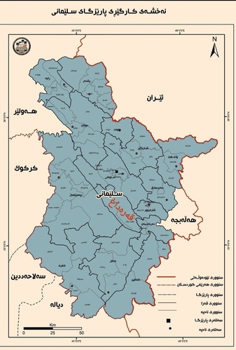
Qaradagh district is one of the districts of Sulaimani province and due to its geographical location, it borders the cities of Sulaimani, Chamchamal, Sharazur, and Darbandikhan. It is also located between "Glazadrda" and "Qopiyakani Qaradagh" mountains. This area is of great importance to Sulaimani province.
The total area of this district is 717 square kilometers and accounts for 3.5% of the total area of Sulaimani province.
Qaradagh district has an old history and dates back to 1663 AD, that is, it goes back to the time when the Babans ruled there. It was later formally placed under the Sulaimani Province. On March 6, 2007, it became a district and Aziz Mina Sofi was the first acting governor of the district.
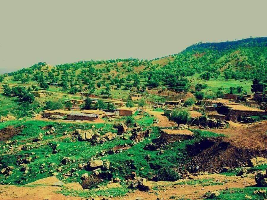
In 2020, the population of Qaradagh district was 12709. There are 22 government offices in the district. The number of villages is 84, of which 63 belong to the district center and 21 belong to the district administration of Sewsenan.
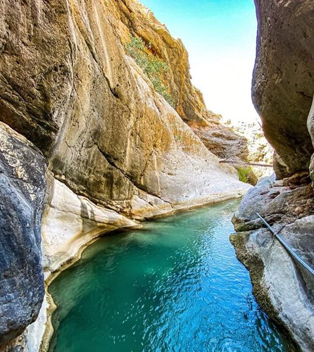
There are several different tourist areas and resorts in the Qaradagh region, the most prominent of which are Tavan, Dari Zard, and Jafaran, each of which is 3-4 km away from the other. There are several water sources in the area and with tourist cabins.
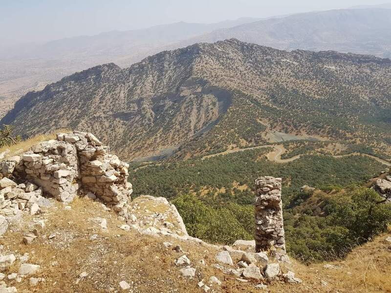
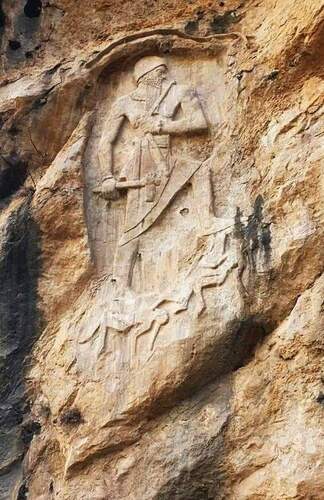
There are 22 ancient monuments in this area, the most important of which are Bawakur Castle, Paykoli Khal Castle, Masuran Castle, Shuray Narmi Valley, and Map of Lulubi King which was known as Naramsin earlier. Also, Bawa Garde Castle and a series of stone tombs, temples, and many other historical sites are noticeable in this area.
Naturally, the border of the region is the extension of the Baranan Mountain Range in the northeast to the southeast, separating it from the Tanjaro River. The continuation of the Sagrma mountain range from the northwest to the southwest separates it from the Chamchamal River. The Basara River separates it from the river of Bazian in the north, while the southern part is an extension of the Dewana River, but outside the Qaradagh region.
Qaradagh district has cold winters and cool and moderate summers. After 2000, many villagers were employed, left agriculture and livestock, and migrated to the cities. Some villages have been completely abandoned.