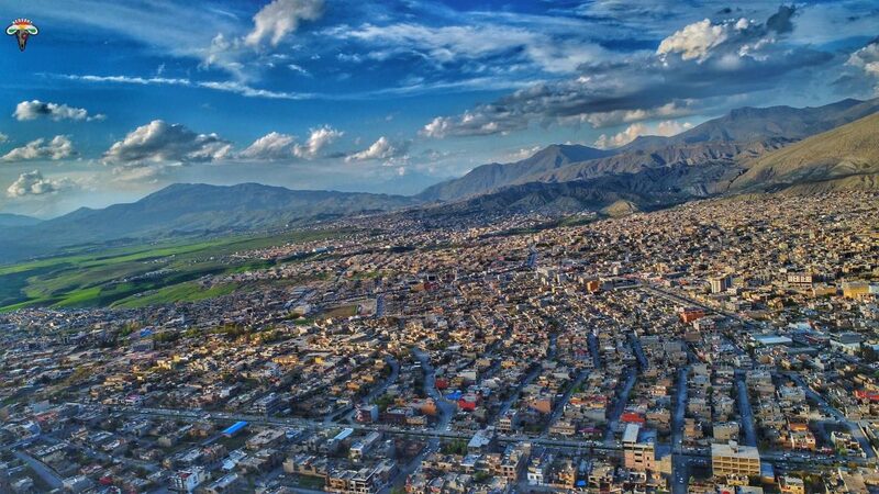
Soran is a city in the Kurdistan Region of Iraq, 115 kilometers northeast of Erbil. It is the administrative center of the Choman, Mergasur, and Rwandz districts, and the origin of Soran district goes back to the Diana district, whose inhabitants were Christians in the past and later converted to Islam with the arrival of Islam in Kurdistan; its population has increased. In 1980, after the relocation of the surrounding villages by the Ba'ath regime, the area was rebuilt and until the uprising, the population was less than 5000 people. However, after the uprising, especially with the return of those citizens who had fled to Iran and the East part of Kurdistan between the collapse of the September Revolution and the uprising, the population of Soran increased significantly and now exceeds 196,000 people.
The Name of Soran
The name Soran comes from the Soran Emirate, which was ruled by Mir Mohammad as an independent state in the 1830s and its capital was Rwandz.
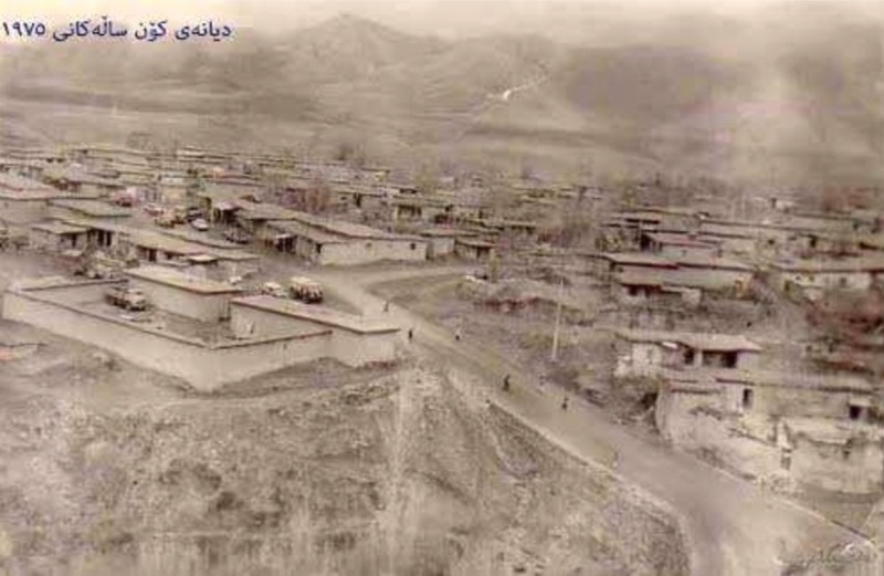
The current location of Soran in 1932
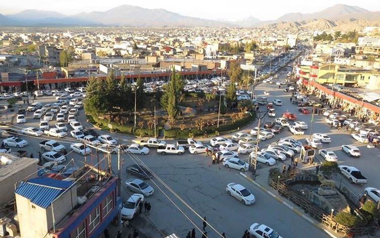
Geography of the center of Soran
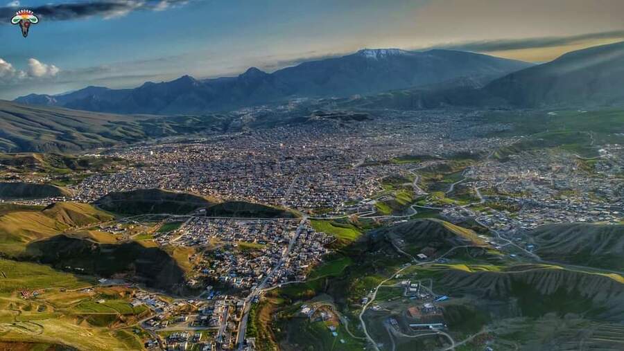
The geographical location of Soran is located in a plain near Rwandz, between Korak mountain, Goraz, Hassan Bag, Bradost, and Handren. This city is located in the northeast of Erbil, 115 to 120 kilometers from the center of Erbil. From 1928 to 1930, when the Hamilton Highway was built from Erbil to Haji Omaran, this road passed through Soran and divided it into two parts.
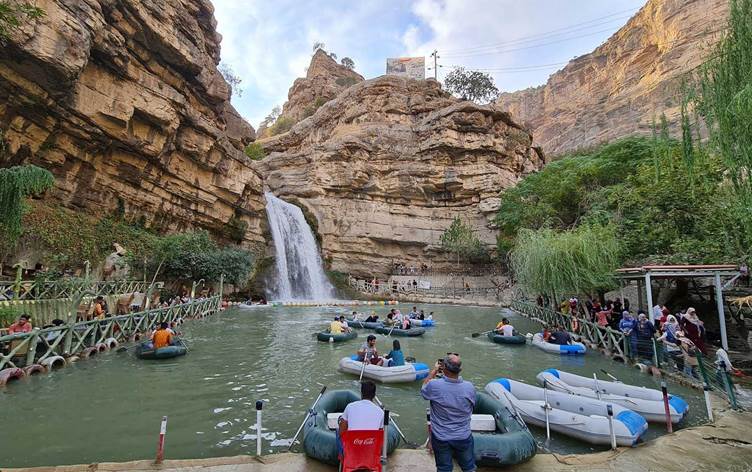
The mountains of Soran are known for their high altitude and the mountainous and natural areas are very attractive and attract many tourists every year.
Five rivers are located in the area: Balak, Balakian, Bekhal, Shekhi, and Bradost. It has cold winters and hot summers. It has Jundian, Bekhal, and Gali Ali Bag resorts.
Soran has a humid climate and two rivers flow through the center of the city and into the Little Zab River, the two rivers "Shekhi and Bradost", the first come from the East part of Kurdistan and the second from the North part of Kurdistan. These two rivers will benefit the Bekhma Dam to be built on the Great Zab River in the future.
Soran has about 900 archaeological sites, many of which have not been discovered yet.
The total area of Soran
The district covers an area of 809,616 dunams and more than 737,000 dunams are used for agriculture.
Suburbs:
Diana is a mountainous area located 2 km northeast of Soran town center. The climate is cold in winter and hot in summer.
Khalifan: A mountainous area located 21 km southwest of Soran town center. The climate is cold in winter and moderate in summer.
Sidakan: A mountainous area located 33 km northeast of the center of Soran town center in the east and northeast of this village borders the East part of Kurdistan. The climate of the village is cold in winter and relatively cool in summer.
The natural environment
Wild pistachio (Qazwan), oak, cherry, Krosk, hawthorn, rhubarb، and Mushrooms are among the local products. There are many other agricultural products such as grains, walnut trees, poplar, apples, pears, plums, pomegranates, figs, and grapes.
It has bears, wolves, leopards, squirrels, snakes, wild cats, beaver, fish, wild goats, and pigs.
Soran City Administration
In terms of administration, Soran town has three districts, Sidakan, Diana, and Khalifan. There are more than 400 villages and 175,000 people in the district center. The town center has 36 neighborhoods, most of which have roads, streets, water, and electricity services. The region has 65 government centers and 45 directorates in Soran, Mergasur, Choman, and Rwandz. It also has 14 political party headquarters, 10 educational and civil society organizations, and five public health centers.