Read the first part of this article here
Shabad
"Shabad" (it is the short form of Shah Abad based on the local people's dialect) or "Shah Abad" was named Shah Abad in 1930 in line with the assimilation policy of fading away the un-Persian languages and cultures and denying their existence. This led to confirming the "Iranian State" that was within the King's Enclosed Countries and was changing into a modern state and was established in the borders of the Qajar country of Iran. This city's name changed to "Shah Abad Gharb" which means a city that is made by Shah and the word Gharb means west, so that it will show that the newly established state of Reza Khan who had recently become Reza Shah includes the whole geography of Iran. There are a lot of examples of the name changes into Persian in the geographical areas of Kurdistan, Ahwaz, Azerbaijan, Balouchestan, Caspian, and … which includes thousands of villages, rivers, mountains, and … Shabad was one of these changes that was chosen to make the newly established state of Iran stronger and changed the city too.
Islam Awa
"Islam Abad Gharb" like Shah Abad Gharb, was chosen for the same reason of changing the names of villages, mountains, and other places in Kurdistan and other nations in Iran into Persian, but this time they had to be changed so that they would show they were Islamic. Thus, in 1979, Ayatullah Mohammad Yazdi ordered to change of Shabad into Islam Awa officially.
The Historical Monuments
Aroon Awa is located amongst several historical monuments, although just one of these monuments has been registered in Iran's National Historical Organization and it is Chiyagawana.
Aroon Awa is located between two mountain chains on the north and on the south of this city stretching from the east to the west. The southern part is either mountainous or covered in trees and the northern part is rather more deserted.
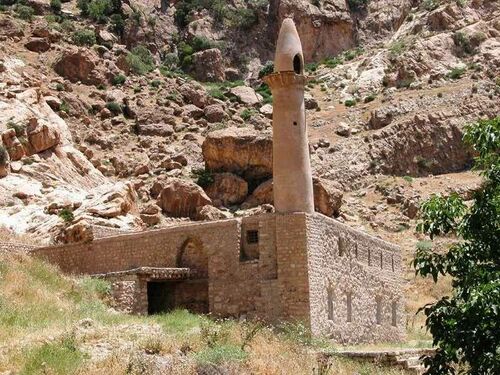
On both sides of the northern and southern mountains, there are historical monuments such as Gutti Castles, Medes, Ashkanids, and Sassanids' high-ranked graves and tombstones. Among these, a castle belonging to the Medes period on the "Qutamay" mountain is overlooking the region which was the headquarters of the authorities who ruled the other mountains, cities, and villages in that area. It was also Javi, Masafa Dawan, and … graves.
Aroon Awa and the towns around it possess many historical monuments such as Tasyari Castle, Tifaq, Ruling Castles, ancient monuments, Gawri graves, and tens of similar cases. There are also tens of historical cases that have not been searched or studied yet.
There are some holy places located in the villages with unique names chosen by this region's tribes, for example, a monument that is sacred to the Yarsan is called Masafa Dawan which was apparently one of the San Sahak companions; or Qaziwan monument that was one of the judges during the time of Emam Hossein, along with Ways and other Pirs' tombs that are sacred for the Sunni Muslims. Ako Jalilian, a Kurdish researcher and author, believes that these monuments were the Medes, Sassanids, and Ashkanids' princes' tombs, and in order to preserve them from plundering, they changed their names like this.
In all those researches done here, there has always been an attempt to erase the Kurdish identity of these monuments and replace it with Arabic identity. These monuments have no national, historical, or cultural relationship with Arabs except for religion.
This attempt was once again conducted at the beginning of the Iranian State in the twenty first century and with a harsh method, the government tried to erase the Kurdish identity of this region and replace it with a Persian-Iranian identity. As an example of such intentions, it can be mentioned that they changed the name of thousands of the geographical areas in Kurdistan.
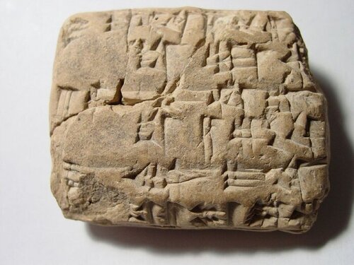
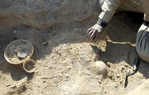
A stone script written in nail characters found in Chiawgana mountain in Aroon Awa
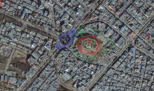
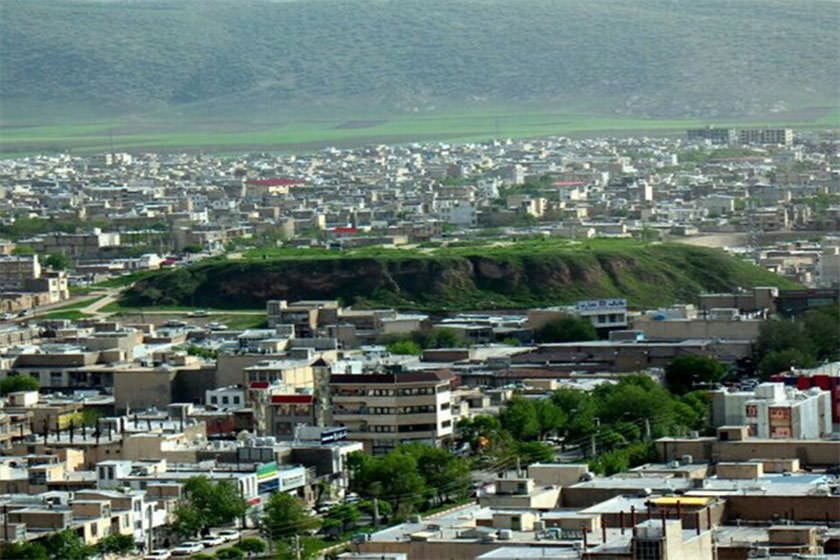
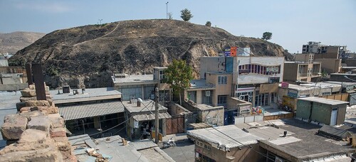
Chiawgana
A discussion about Aroon Awa and Kalhor region is not complete if Chiawgana is not mentioned. Chiawgana is a historical hill that looks like Hawler (Erbil) Castle in the middle of Aroon Awa city; in other words, Aroon Awa is built around Chiawgana.
It is a hill of more than 15 thousand meters in width and 25 meters in height. A part of this historical monument has been ruined by people due to house building projects and almost 10 thousand meters of it are left. It has two floors that are estimated to have been built with a time gap of 100 to 150 years. This place has many rooms. The east wing was for the Rulers to settle in and the west wing was dedicated to official affairs and industrial works.
In 1936 Erich Schmidt began his primer research and took some aerial photos of the place. In 1967 a group of Iranian archeologists began their diggings and based on the result of their researches, some items belonging to the neo stone era to the Iron era and Ashkanids' have been found here. They estimated that the history of this place might be more than 5 to 8 thousand years.