
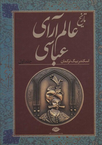
The word "Mukri" was first used in historical sources during the Safavid Turks by historians such as Askandar Beyg Turkman, author of Alam Arai Abbasi, Khandmir, author of Summary of the News, and Habib al-Seir, one of the great historians of that period. For the first time in the historical sources of the Safavid period, the sources that describe the events of the reign of King Ismail I of the Safavid period mentioned the Kurds of Mukri. The sources mentioned the name of Sarm Bag Mukriyani, who was the son of Saifaddin Khan. After these two, their descendants became the rulers of Mukri, whom we will mention later.
Mentioning the Mukri tribe, these historical books referred to it as a Kurdish-speaking tribe. Later, during the Safavid period, a Kurdish historian named Sharaf Khan Badlisi mentioned the Kurds of Mukriyan in his book Sharafnama. The life, geography, and extent of the Mukriani rulers are discussed in detail in Sharafnama. Detailed information is also available about the nature and extent of the power of the rulers and emirs. As we know, the rulers and princes of the Safavid period never had the same glory and power. Some had more power, military rank, ability, and income, while others had less power and therefore less soldier rank, income, and ability. According to Sharafnama, the rulers of Mukri were as powerful as the rulers of the emirs of Soran and Baban.
The fact that Askandar Beyg Turkman, as a court historian, constantly mentions the Mukris in his book 'Alam Arai Abbasi', shows that the Kurds had a great influence during the Safavid period and had good military and economic positions and their influence on the events of the Safavid period. The historian considers all Kurds living south of Urmia Lake to be Mukri Kurds. Both he and people like Mirza Beyg son of Hassan, also known as Janabazi, in his book Rawzatu-Safaviya, which describes the history of the Safavid dynasty from the beginning to the fortieth year of King Abbas's reign, consider Mukri as the province of Kurds whose language is Kurdish and their power is located below the Urmia Lake. Their relations with the Safavid kings were changing. Sometimes their political relations were at their best, and sometimes their relations with the Safavid kings were not good and they were in serious conflict.
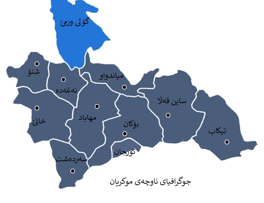
The region has had many names from the sources of the Safavid period to the sources of the Qajar period. Names have been added, but Mukri has been retained in all names. For example, it is called Mukri province, Mukri Kurdistan, Mukri Sablag, Sablag government, Mukriyan, North Kurdistan. The name is derived from the name of a tribe that came to the region. That is, the people of Mukriyan belonged to a tribe called Mukri. But we must probe different sources to find out where the political geography in which the tribe lived was.
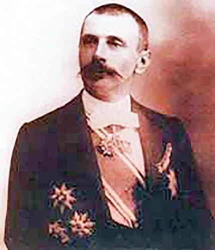
Jacques DeMorgan
Information varies from source to source. That political geography has changed a lot. The borders of Mukriyan changed constantly from the Safavid period to the Qajar period. In other words, sometimes the borders under the rule of the Mukri emirs withdrew and expanded to near Dehkharqan, now Azarshahr near Tabriz, and sometimes these borders were narrowed near Mianduaw. According to sources, the western border of Mukri province is the current border between Iran and Iraq. The southern border of the region is historically known as Ardalan Kurdistan or the area separated by the Jaghatu River from its lower region. The eastern border according to the writings of great writers such as Demorgan, a French geographer, in his book "Historical Geography of Western Iran", the Jaghatu River is recognized as the border of Mukri province and Maragheh. The author, DeMorgan, says that the province of Mukriyan extended from the north to the Urmia Valley, the Sindus and Shno (oshnaviyeh) regions. According to an article written by DeMorgan, he accurately determines the extent of Mukriyan and because of his relationship with Sardar Aziz Khan of Bokan, he may have received the information from him, who was himself an emir of that region. Demorgan defines the boundaries of Mukri province as follows: Mukri province includes Sablakh, Bokan, Sardasht, Lajan, Piranshahr, Naghda, Sindus, Shino, parts of Saqqez, Mianduaw and Sayin Qala or Shahindezh, which is on the right bank of Jaghatu River. It was then that the geography of Mukriyan became quite narrow; That is, in the Qajar period.
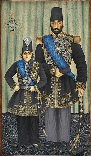
Sardar Aziz Khan of Bokan and Muzaffaraddin Shah of Qajar
People living in the Mukriyan region, in the geography mentioned above, speak one of the Kurdish dialects called Sorani. According to the writings of the historian for Mahabad, Sayed Mohammadi Samadi, who quoted from a historical manuscript, the Sorani dialect is the dialect of the Kurds who speak it in Kirkuk, Sulaimani, Sharazur, Koya, Harir, Sablagh, and parts of Bana. The dialect spoken by the people of Mukriyan has unofficially become the standard dialect of Kurdish writing because most Kurdish and literary texts have been written in it. According to DeMorgan in his book, Mukriani is the purest Kurdish dialect among the eleven Kurdish dialects and has been less influenced by non-Kurdish languages than other dialects. He attributes the reason to the fact that the mountains of Mukriyan have preserved both the Mukri language and the customs that were in Mukriyan and are specific to the Kurdish people.
Due to its geographical extent, the Mukriyan region covers both mountainous and highland areas and plain areas. In other words, it has some characteristics that distinguish it from other parts of Kurdistan in both plain and mountainous areas. The highest mountain in the Mukriyan region is Chikhidara, which is 3611 meters high. However, the plains of Mukriyan are very important and cover the lands that are very fertile and today form one of the best agricultural areas of Iran. These plains include Lajan, Sharweran, Kona Lajan, Shamat, Kalwe, Wazni, Sindus, Bokan plains, and Majidkhan River plain. These are the important plains that are geographically called "Steppe" in Persian. They are the plains that are influenced by the streams that come down from the mountains and have the removed soil that is very fertile for agriculture, Mukriyan is known as the grain warehouse of Iran and Urmia province.


